
The last five days of the Cedros-Alpamayo Circuit were, in many ways, the most remote and the most dramatic portion of our experience of the Cordillera Blanca. Now that the popular Santa Cruz portion of the trek was days behind us, we ran into far fewer hikers and felt like we had this alpine wonderland largely to ourselves, that is, except for the sheep and alpaca. Day 7 brought us to the Cara Cara Pass and revealed the first of many stunning views of the picturesque namesake peak of Alpamayo. Day 8 was a short and relatively easy trek that afforded us time to explore the moraine below Alpamayo before leisurely stolling down Quebrada Alpamayo on a relatively flat path for a change. Day 9 presented a long and challenging 2-pass day with impressive views of Laguna Cullicocha at the end to erase at least some of the weariness. Day 10 began the long, slow departure from the mountains as we headed out of the Cordillera Blanca and down toward the village of Hualcayan. Day 11 finished the trek and brought us back to Huaraz for a few creature comforts: hot showers and cold beer to celebrate our successful return!

What follows is a detailed description of our last five days on the trail. We hope that this first-hand information will be valuable to those planning to do this hike. If that’s not you, we hope that you’ll enjoy looking through the photographs anyway. Happy trails!

Trail Description: We crossed two rivers as we set off across the pampa toward Quebrada Tayapampa. At first, we followed the remote dirt road that heads to big and small Safuna Lakes and enjoyed the slow, gradual climb in elevation here.


After a few kilometers, we left the road and headed straight up the hillside to magnificent views of Pancujirca and the whole Santa Cruz range. Today’s gentle switchbacks over the contoured hillside up to the day’s first pass, Mesapata, at 4460 meters come as a welcome change to the intense climb we faced yesterday.
From the pass, it was a gradual descent along a hillside track into Quebrada Mayobamba. We crossed the valley and the stream running through its middle and began the ascent towards Cara Cara Pass along a single-track trail that was occasionally quite muddy.
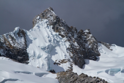
The final push to the pass involved steep switchbacks, long at first and then quite short, as we zig-zagged our way to the top. There we were greeted by an impressive range of snow-capped peaks, including Alpamayo, Choqicalki and Big and Small Santa Cruz.
From there, it was several kilometers straight downhill to camp beginning with a very steep descent from the top of the pass. With each step down, we gained better and better views of the northern face of Alpamayo, the Santa Cruz range and the bright blue laguna below. We stopped to take pictures of the stunning scene at several points on our way down and at the river just before reaching camp.

Tonight’s camp is next to a small river in full view of Alpamayo. We were amazed to discover that we would share this incredible location with only one other group of three Swiss backpackers for the evening. Unbelievable!

Trail Highs:
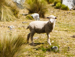
We slept very close to the hamlet of Huillca (3 houses total!), and there was a herd of the villagers’ alpaca grazing near our tent in the morning. Before taking off for the day, we spent a few minutes photographing the docile herd. It’s not exactly wildlife, but we couldn’t resist all that fuzziness.
It took a while for the sunlight to reach us in our camp low in this valley, but it had a beautiful, golden quality to it that made everything it touched look exquisite. Can you imagine having this view in your backyard?

The views from Cara Cara Pass nearly blew our minds. We hiked hard and slept in the freezing cold to get to this exact spot, and it was worth every hard-earned step!

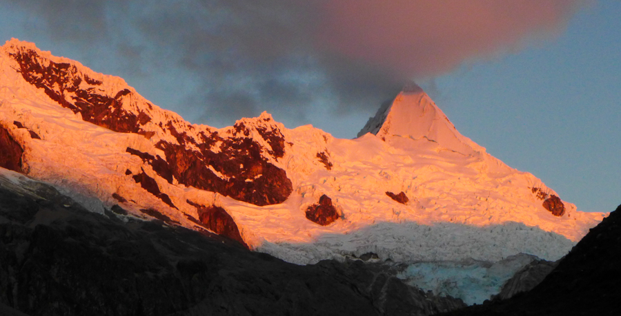
Just before dinner, the setting sun cast a stunning pink hue on Alpamayo, the reigning femme fatale of the Cordilleras.
Trail Lows:
The wind was super intense at the top of Cara Cara Pass making it downright frigid and slightly unsettling to be there. But, with scenery like this, there was no way we were short-changing ourselves on time here. So, we layered up, and, out of fear of being blown right off of the pass and into the great abyss below, we plunked ourselves down and sat on our bums while we snapped as many photos as possible from the safety of our seats. It might not have been our finest moment, but we got the shots. What can we say? We suffer for our art, right?

The first 100 meters or so down the pass was the most steep and slippery we encountered on the trail so far. I picked my way slowly down the trail and felt relieved when the grade finally reverted back to just the normal grade of crazy Peruvian steepness that I had become accustomed to. Matt took an entirely different approach, “surfing” down the slippery trail. Oh, if only I could be so brave!

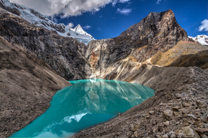
Trail Description: With only 7 kilometers to our next camp, we decided to take advantage of the day’s short mileage and sleep in before taking a side trip up to a closer view of Laguna Jancarurish. We followed the trail out of camp towards Alpamayo and eventually had to make our way across the small, rushing river by boulder hopping. From there, it was a steep climb up the boulder-strewn moraine to a spectacular viewpoint of the jewel-blue lake below the peaks of Tayapampa, Jankarurish, Alpamayo and Santa Cruz Grande.
Working from a narrow ridge with a sheer drop off to either side, we enjoyed taking photos of the grand scene, too amazed by its splendor to be bothered by our precarious perch.

Every once in a while, an alpine scene grabs hold of your soul and won’t let go, and this was one of those places that spoke to us deeply and reminded us why we love alpine trekking. We could have savored this scene all day long, but, reluctantly, we packed up our gear to begin the hike on to our next camp.
We continued along the ridge above the lake for a bit before, casting one last backward glance at perfection, we headed down the moraine and retraced our steps across the river and back towards last night’s camp. From there, we continued on a single-track trail on a ledge about 100 meters above the Quebrada Alpamayo, a long, gorgeous valley with the river rushing through and amazing views of Alpamayo behind us for most of our way.
Trail Highs:
Our side trip to Laguna Jancarurish took us to the most unbelievably beautiful and grand alpine scene. Per usual, I hated having to cross that little river to get there, but I am glad we did. Boy, was it worth it!

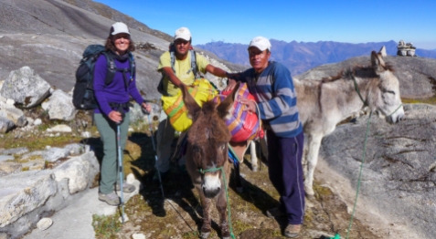
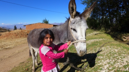
One of the best parts of having a friendly local guide like Eliseo is being able to chat with the locals. Although we speak a little Spanish, our Quechua is pretty pathetic, so Eliseo served as translator as we learned a little about these two shepherd girls who come from a nearby village. They were kind to pose and smile (a rarity!) for photos for us, but our favorite shot has to be the last one, taken at a distance, giving a sense of place to them and a glimpse of how the two teenage girls spend their days—a world of difference from the kids back home!
There was very little elevation gain on the trail between camps today, and, after the past couple of days that we have had, our tired feet were quite happy for the break.

We arrived in camp on the early side today, and, with the extra time and our camp’s close proximity to the river, we got a very special treat: a hot shower! We set up our toilet tent in a grassy spot while Eliseo heated water up for us to bathe with. Even though it was just a bucket shower, it felt so luxurious to wash our hair and clean all the sweat and grime off of our filthy bodies—a total reset. What a treat!
Trail Lows:

Today was our easiest day on the trail so far, and we were both feeling alright health-wise, so there were really no lows to speak of. And, if you start your day with an epic view like this one, it’s kind of hard to feel right about complaining, no?

Trail Description: For today’s hike, we had a simple task—just hike up and over the valley wall before heading on to the next camp. No big deal! And it started out simple enough. For the first thirty minutes, our day felt like a continuation of yesterday, following the trail as it gradually ascended higher and higher above the narrowing quebrada below us.
For the next half hour, we hit a series of long switchbacks which took us higher up the valley wall on a trail of loose rock. After a short break, it was another two-hour push of even longer, more vertical switchbacks. That’s when it finally occurred to us that the only way we were getting out of that valley was to keep beasting it up and over the high wall surrounding us.
We found it mentally challenging to be working so hard yet more or less feeling like we were simply going back and forth in the same spot for hours on end. It was a definite feeling of relief when we finally made it to Vientunan Pass at 4760 meters (15,600 feet), where we enjoyed our lunch and a well-deserved, long rest before beginning the next segment of the trail.
This next stretch between passes was deceptive. It looked like a simple down and back up to the saddle, dropping 300 meters and then gaining 400 meters to reach Toropistonon Pass at 4860 meters (15,945 feet). The trail, though, was tough-going with lots of loose rocks and occasional long stretches of mud helping to deter our progress and add to our growing fatigue.
Once we climbed back out of the bowl, however, we discovered we had to make our way around the back side of the range to find our pass. It was beautiful, but we kept reaching false passes and had to try our best to stay positive. To be perfectly honest, by this point in the day, we were both so tired that the repeated disappointment of not being finished with the uphill nearly did us in.
The trail felt like it went on forever today, but once we finally made it to the pass, it was a relatively quick descent down to a spectacular viewpoint overlooking Laguna Cullicocha, an artificially dammed lake, and the entire Santa Cruz range.
From there, we continued our descent down to our camp at the end of the lake.
Trail Lows:
We are going to shake things up a bit and start with our Trail Lows. After such a long and tiring day, it was a little disheartening to see our lackluster campsite tucked into a cramped and uneven spot near the end of the Laguna Cullicocha. The ground was super rocky and lumpy, and dark clouds made it appear like a big storm was going to move in. Surprisingly, there was actually a refugio right near by, and we hoped that maybe we could sleep in the hut and give our tent to Eliseo and Shefi, since the dining tent where they slept had no floor. No such luck! The hut never opened, and we all had to make do. The presence of several man-made features detracted somewhat from the otherwise placid location.

Trail Highs:
It wasn’t all bad, though. That lackluster campsite happened to be located just a stone’s throw from this view of the lake. The rain never materialized, and we spent about an hour running around on the cool magma-like rock formations just as the sun was setting capturing images of the the lake with still water and ethereal pink clouds—a rewarding ending to this tough day on the trail!


Trail Description: For the first thirty minutes on the trail, we descended the canyon, occasionally crossing the rubber-lined aqueduct that carried the rushing water from Laguna Cullicocha to the hydroelectric plant that supplies power for the entire Huaraz Valley.
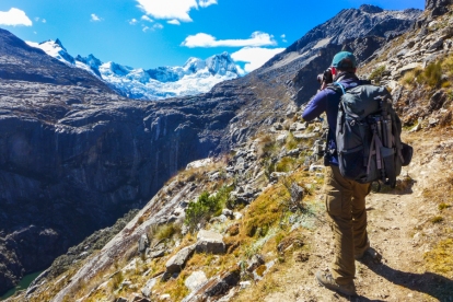
Eventually, we said goodbye to the Santa Cruz range, turning the corner and entering a totally different terrain. We followed the switchbacks down the steep, grassy slope while looking across the valley at views of the dry Cordillera Negra range, as well as the villages and farm fields below. The trail continued, skirting the outside of the mountain on a gradual descent with vertiginous views down into the Cañon de Pato and the mountain villages below. Eventually, we hit switchbacks which continued for nearly two hours.
Tonight’s camp above the village of Hualcayan was a little makeshift. We discovered the villagers have planted a potato field where a more comfortable and spacious camp used to be, and Sheffi did his best to find a flat spot for our camp nearby. Our tent actually had to be propped up on one side to have a big enough footprint for us to both sleep and not roll down hill in the night!
Trail Highs:
Breakfast al fresco: One upside of the lack of suitable space for our dining tent (aka Eliseo and Sheffi’s sleeping quarters) was that there was a flat, stone pad on which breakfast was set for our enjoyment. There’s nothing like dining al fresco in the Cordillera Blanca! It felt a bit like the reward given to the remaining contestants who make it to the final jury in “Survivor”!

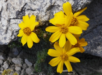
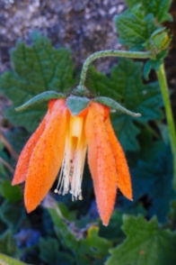
Colorful flowers: Now that we are leaving the high altitudes behind, we are finding the breathing a little easier, and it looks like the flora is, too. There were several pretty species of flowers vying for our attention on the trail, and what can we say? We are total suckers for a pretty flash of color every time.
A birthday celebration: Alison was cursed as a child with a summer birthday, so she never got to bring cupcakes to school. As an adult, however, she has made up for this by celebrating her birthday in some of the most amazing places all around the globe. Here’s to another turn of the year on this spectacular planet.
Glorious sunset: Despite our strangely slanted makeshift campsite we entertained ourselves during the heat of the afternoon by observing a few hummingbirds buzzing near our tent. But it was the sunset that stole the show as it played with the clouds and produced that elusive “God light” effect. At times like these, it’s best to keep clickin’!


Trail Lows:
Missing beautiful alpine scenery already: the long, slow come-down from the heights of the Cedros-Alpamayo left something to be desired, but the re-entry into agrarian pastoral life reminded us that the mountains are home to many who depend on this land for a living.
Another ho-hum camp: if we had known what the last camp was like we probably would have chosen either to stay in a different location further up the mountain or gone the extra distance to the finish line. The only trouble would be that we would either have had to stay in the village or have faced a long drive back to Huaraz and arrive late at night.


Trail Description: We broke camp and and hiked a quick hour down the remaining zig zags through the scrubby, desert-like terrain to the village of Hualcayan, 400 meters below. As we passed cultivated fields of peas and maize, we took note of the impressive irrigation system used by the villagers to harness and channel water from the mountains. We met our van from Huaraz at the designated pick-up point, unloaded the burros and said goodbye to our dear friend Sheffi, who had worked so hard to help us have a great experience.
Before long, we were loaded into the van and driving the long, dusty road back to Huaraz. The end to another great trek!
Trail Highs & Lows:
We’re done!: Finishing a great trek is always a bittersweet moment for us. The euphoria of finishing a trek and realizing that we don’t have to hike another kilometer is always quickly replaced by the sad realization that we have finished a trek and realizing that we don’t get to hike another kilometer.

The only effective way we have found to reconcile this feeling is to start planning another great adventure. Stay tuned for more!
















The sunset shots of the final day are stunning.
That was definitely one of the most interesting sunsets we have ever had the privilege of seeing. Glad you liked the shots!
Great post. The photos are excellent.
Thanks, John! We always enjoy your trail photos, so we are happy to return the favor. 🙂
As you write I can feel the fatigue of those long days. Too bad about the campsites but those sunsets are remarkable! What a location for a birthday. 🙂 Looking forward to reading about the next adventure planned!
Thanks, Sue! I have been fortunate to spend my birthday in some pretty incredible places over the years. We still have one more trek to show from Peru, and then we are looking forward to sharing about our incredible summer of backpacking here in the US! Thanks for reading!
Wow! What an adventure! The photos look incredible- I can only imagine what it must have been like in person. This is your buddy Jared from Team Texas you met in Utah. I just wanted to say hello. I believe you guys are out on the JMT at the moment, being the raddest pair of teachers I know, but shoot me an email when you get back. Can’t wait to hear about your trip! -Jared
Hey Jared! So nice to hear from you! Peru is a great destination for trekking, and the weather is best for it during our summer. You should think about it for one of your next summer vacations, being a fellow rad teacher yourself! 🙂 We loved meeting you and the rest of Team Texas in Zion. Now that it’s back to school season, we will be posting about this summer’s amazing adventures, including Zion and the JMT, so we hope you will stay tuned!
Absolutely magnificent photos!
Love the table on the mountain top, the turqouise waters, the stunning sunsets, the campsite and the mountain folk.
What an incredible adventure! I really like the brewakdown into highs and lows. Terrific post!
Peta
Thanks, Peta! This area of Peru is so beautiful, I’m not sure we did it justice. We really appreciate you visiting our blog and taking the time to comment so thoughtfully. Cheers!
Wow. You two always do some epic treks, but this looks more mind-blowing than most. The Laguna Jancarurish and the view from the pass seem worth the effort on their own. Love the nature photos of course – they are awesome – but I really like the shot of the two girls in the top gallery. Great work.
Thanks, Jeff. We loved hiking in Peru for the spectacular scenery, but one of the best things about being there was experiencing all of the cool culture, too. It’s pretty awesome to feel like you are walking through a National Geographic photograph for 12 days straight! 🙂
We call those “National Geographic Moments,” but you got it for nearly two weeks!
Well, it seems like you are doing a really nice job of living a “National Geographic life.” Kudos to you!
What an amazing experience! Those mountains, the lakes, rocks…fantastic landscape…and the photos are gorgeous! We are a bit curious as to how did you find about this stunning place? Normally you hear about Peru´s Machu Picchu or the Nazca lines but …Cordillera Blanca thats new to us 🙂
Thank you so much! We love hiking, and talking travel, so whenever we meet other people who seem to share our passion, we are sure to ask them about some of the places they have been that they have really loved. We had never heard about the Cordillera Blanca either until the summer prior to Peru when we were hiking in India and two different people told us about the fantastic hiking and landscapes there. We sure are glad we took their advice and headed there. The Blanca is awesome!
What are some of your favorite places you have been to?