
Day 2: La Verkin Creek, Site #11 to Wildcat Canyon, 14 miles
The alarm goes off at 5 am to wake us up for a big day on the trail. We still aren’t sure how fast we will be hiking with our full backpacks over the Zion terrain, and we have a 14+ mile day ahead of us, so we want to get an early start. We stored most of our food in a bear vault overnight, but we hung a few excess items in a nylon bag from a low branch of a tree. We discover that a mischievous mouse has chewed his way through the bag and into two plastic bags to get at our crackers. Lesson learned. We enjoy our breakfast on a large boulder overlooking the river. Life is good!


We are on the trail by 7:00, not too bad for day 2 of the trip. We retrace our steps back to the trailhead leading to Hop Valley and begin the long but beautiful climb out of Kolob Canyon. This is the first time we’ve encountered any real elevation on the TZT, and we’re glad we have fresh legs to carry us up, up, up.
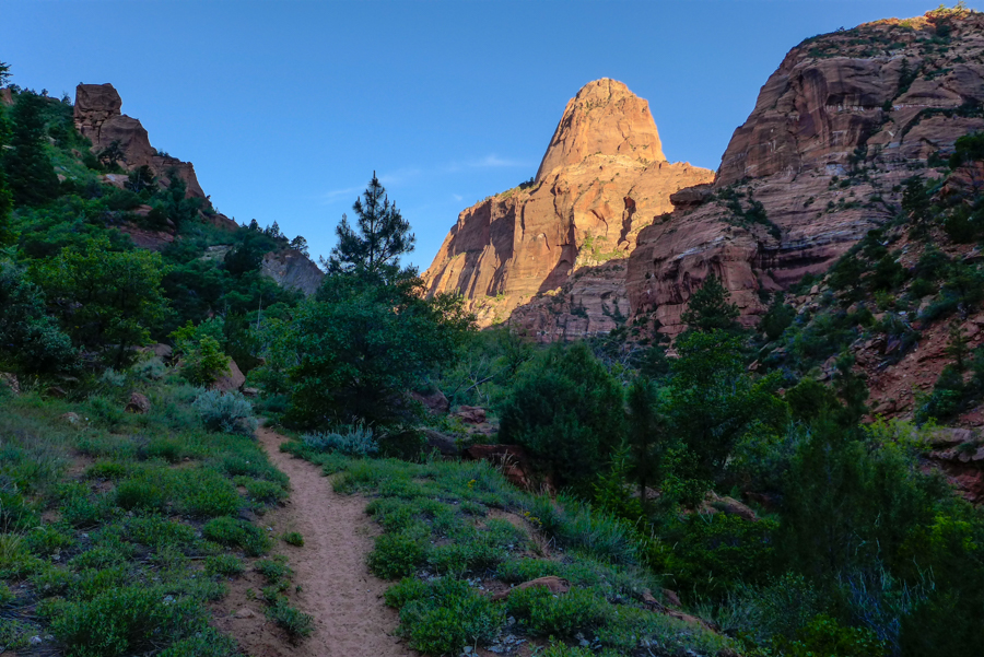
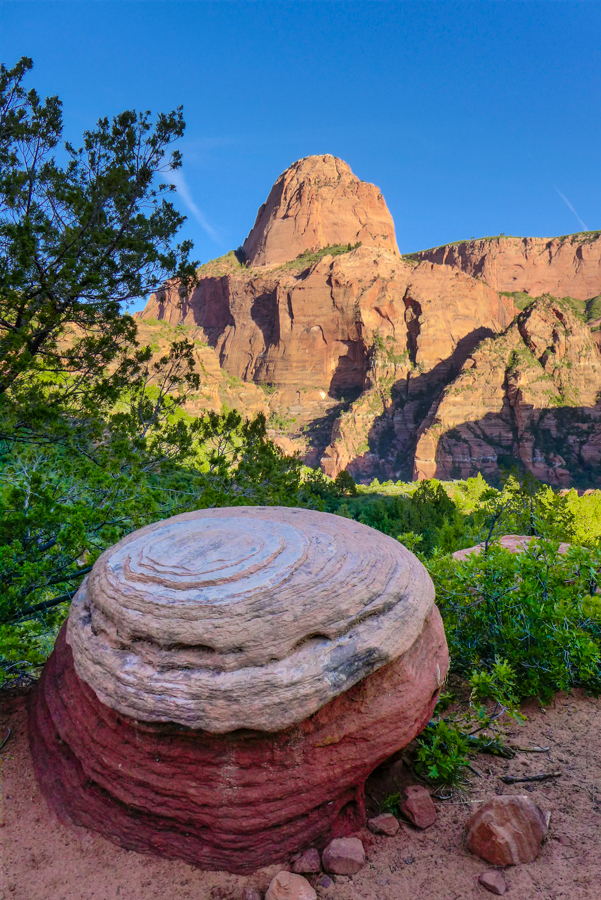
At the top, there is a really cool giant round rock, and Matt insists on pulling out the tripod and DSLR to capture the scene. As he is setting up, a peregrine falcon flies by and lands in a tree across the divide. The early morning light is magnificent on all the rock formations, and we feel revitalized and ready for more when we finally pack up and hit the trail again.
Hop Valley now stretches out below us as we descend into this relatively lush area. We have been warned not to drink water from anywhere along this stretch of trail as it has been contaminated by the cows that graze nearby. With little else in the way of description to go by, we don’t know what to expect, but we are pleasantly surprised by how beautiful it is. After passing two campsites, we go through a cattle gate and then cross a very shallow stream that flows through this idyllic little valley. The trail follows its sandy shore.

Every so often, the footprints in the sand disappear into the water, and we have to cross the stream and pick them up again on the other side. Over and over we do this. Our boots become caked with the sandy mud, but our feet stay dry.
Eventually the trail runs into a marshy flat. A trail sign points up a sandy knoll, and we follow the steep, sketchy trail which climbs straight up the hill and immediately down the other side. As we slide down the sand to the bottom, we meet a group of three fellow TZT backpackers coming down from the adjacent knoll who tell us that we all have headed down the wrong trail. We consult the map together and decide that we will have to bushwhack our way across a marshy section to pick up the real trail. Everybody is cursing whoever put a trail sign up pointing us in the wrong direction!
We take a break to eat a snack before heading out of Hop Valley along a steep dirt road that must be used by the ranchers who own the section of land adjacent to the park property. We see signs as we make our way through Hop Valley that indicate where we have left the Zion Wilderness and entered private property.
It’s now 11 am, and we are starting to feel the heat of the day. The trail up is long and hard. We steal short breaks in the shade where we can find it and relish any refreshing breezes that blow.
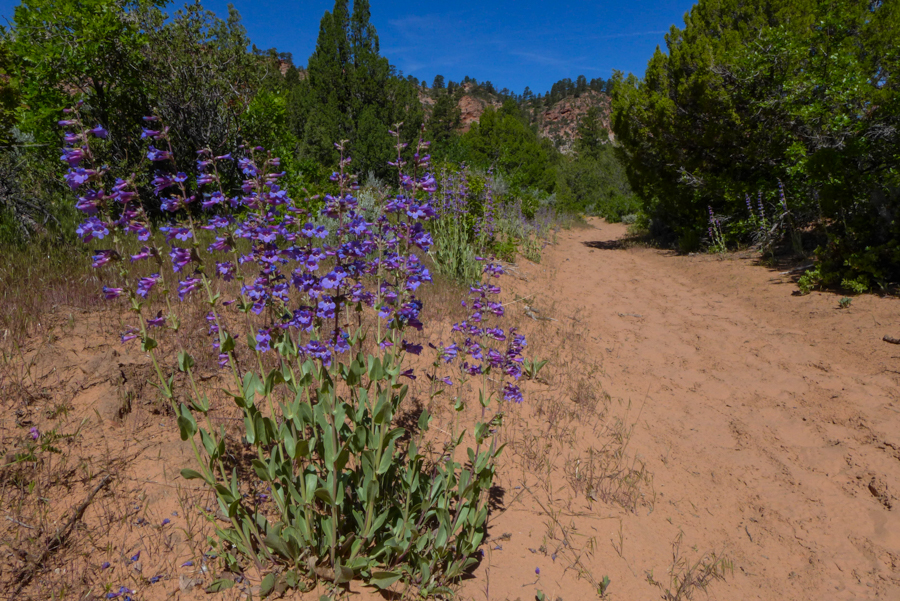
Finally the trail flattens out and skirts along an interesting outcropping of rock. We recognize the scene here from dropping off extra water at the Hop Valley trailhead the night before we set out on the TZT, so we know we must be getting close to our cache. Matt amuses himself by looking for birds (most of which we don’t recognize) and gets super excited when he spots a beautiful lazuli bunting—a new one for both of us!

We finally arrive at the Hop Valley trailhead and are relieved to recover our water cache. We will need these extra liters of water to get us safely to our next campsite which is still over six miles away.

The only shade available is on the concrete pad outside the privy, so we join the group of three we met earlier on the sandy knoll who are also resting here. Michelle, Olivia and Mark are from San Diego and are doing the whole traverse like us. They are fun to chat with as we eat lunch and recover from the morning hike. We all strip out of our boots and socks, and the cool cement feels so refreshing on our tired feet.

We also get an unexpected spa treatment in the privy. I usually make it a habit to squat in pit toilets, but this one looks brand new and is really clean. My legs are super tired, so I take advantage of the welcome opportunity to sit. For some odd reason, there is an updraft of cold air coming up from below. It’s a little startling at first, but, on second thought, it feels rather refreshing on the undercarriage, if you get my drift!
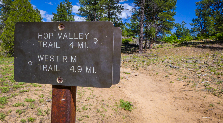
After lunch, it’s finally time to wrap up our spontaneous little potty party. With our hydration bladders topped off, we bid adieu to Team San Diego and are back on the trail, taking the 4-mile Connector Trail toward Wildcat Canyon.

The trail starts off with great views of the rock formations. Lots of sandy sections on the trail add an extra level of difficulty to the trail. At times, it feels like we are walking on a beach.


Eventually the trail ducks into a forest of pine trees that seem more reminiscent of Wisconsin than Utah! It’s nice enough, but we really want Utah back. On and on we trudge through the forest, and even the start of Wildcat Canyon does little to improve the view.
Tonight, we have a wilderness permit for dispersed camping in this section of the trail. Instead of having a designated campsite like we had last night, we need to find a suitable place to pitch our tent on our own. This is what we will experience on the John Muir Trail this summer, so we figure it is good opportunity to practice. We are eager to see what the terrain in Wildcat Canyon will look like. Will the sites be easy to find? Inviting? Isolated? The more we walk, however, the less welcoming it seems, and the less likely it appears we will find hospitable ground to camp on.
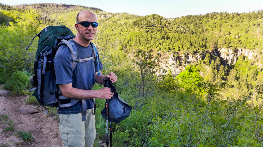
Eventually the thick brush opens up into a clearing, and we see that Team Texas (with whom we shared our shuttle on Day 1) has set up camp here for the night, but none of the boys are anywhere to be found. We keep moving on looking for them and the spring that promises fresh water for tonight and tomorrow on the trail. We hope that we can camp somewhere close to it.
At a small bend in the trail, two German hikers whom we met briefly yesterday are setting up camp only inches off the path. They tell us that the spring is just around the corner but that there are no campsites further ahead, at least not anywhere close by. Ughh!
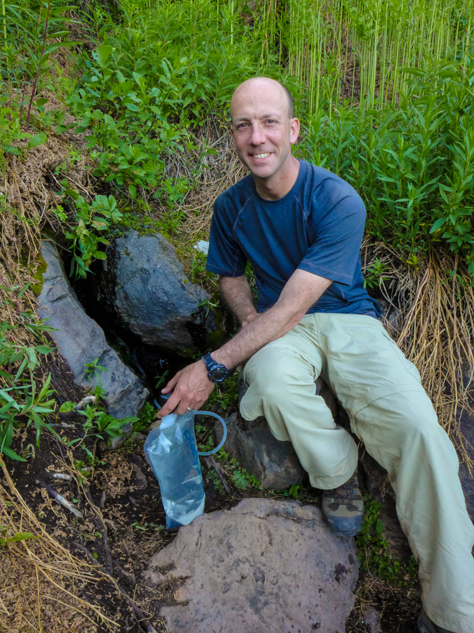
Team Texas confirm this once we reach the spring, and we decide we better head back to their campsite for the evening, even though this will mean a 20-minute slog back up the hill with full hydration bladders. Ughh! We are not willing to risk pushing ahead without some assurance that we will find a suitable site to pitch a tent. On the plus side, back at camp we are treated to a medley of songs on Jared’s acoustic guitar, some pleasant trail camaraderie, and even a male deer wandering through camp at dusk before calling it an evening. It’s a fine finish to the day.
Pin It!


Enjoyed taking the trail with you via your gorgeous photos and great descriptions!
Thanks for coming along on the ride, SueBee! 🙂
Does it ever seem daunting to wake up in the morning and know that you have to carry FORTY PLUS pounds on your back for FOURTEEN MILES?
Sure. But that’s definitely part of the fun, too. We enjoy a good challenge!